
Tongchang Fm
Type Locality and Naming
East Guizhou. The Tongchang Fm was named by the Party of Regional Geological Survey, Guizhou Bureau of Geology in 1974. The type section is at Tongchang, Jiangkou County, central Fanjing Mountain, Guizhou Province. Middle formation in the Fanjingshan Gr.
Synonym: (铜厂组) , Tongchangkou Fm
Lithology and Thickness
The Tongchang Fm is composed of rhythmic thin-bedded interbedding of meta-sandstone, siltstone, metamorphosed tuffaceous sandstone, sericite phyllite and slate. Lower part is dominated by grey, grey-green and dark-grey phyllite and slate, sandwiched with meta-siltstone, sandstone and minor volcanic lava. Upper part consists of greyish dark-grey and minor grey green metamorphosed fine-grained sandstone, tuffaceous sandstone, intercalated with phyllite, slate and minor metamorphosed diabase and spilite. The clastic rock in the middle- and upper-part bears microplants. The formation is 860-1204 m thick.
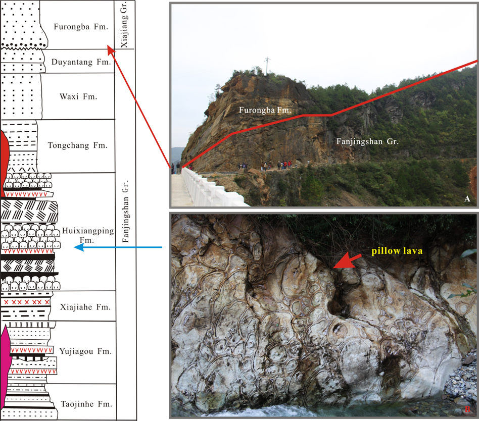
[Figure: The stratigraphic column of the Fanjingshan Gr (the group is about 1000 m thick). a. Pillow lava of the Huixiangping Fm.; b. The boundary between the underlying Fanjingshan Gr and the Furongba Fm (= lower Jialu Fm?) which is the basal formation of the Xiajiang Gr.]
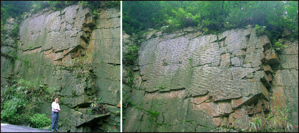
[Figure: The Tongchang Fm in Heiwan River of Jiangkou, Guizhou Province (photos by Zhang Jianshu)]
Relationships and Distribution
Lower contact
It is in conformable contact onto the underlying Huixiangping Fm
Upper contact
It is conformably overlain by the Waxi Fm
Regional extent
East Guizhou. Southeast of Fanjing Mt Guizhou Province.
GeoJSON
Fossils
Protosphaeridium, Protoleiosphaeridium, Polyporata.
Age
Depositional setting
Additional Information